Collioure‘s coastal path, also known as “The customs officer’s trail”, is one of Collioure’s unmissable activities.
This hike, which you can start from Collioure and continue as far as Cerbère or even Cadaquès, offers a variety of natural treasures. Along the way, you’ll come across beautiful, authentic coves, sandy and pebble beaches, terraced vineyards and an abundance of flora and fauna.

Good to know! 
Bring good shoes, walking sticks for the steep sections, water and don’t forget your swimming costume!
This walk is suitable for families as long as you have good footwear and are used to walking. It’s also a very pleasant walk to do with friends, alone or as a couple!
Check the weather conditions before setting off, and in summer, prefer morning hikes. Always follow the signposted path.
To avoid having to walk back the same way you came, consider the €1 bus or the train.
The geotrek website also lists all the walks you can do in Collioure and the surrounding area, with a map.
Let’s protect the coastal path.
This walk is a natural treasure, so let’s protect it and respect it so as to cause as little damage as possible to the coastal and marine environment.
- Take all your rubbish with you if you go to the beaches, coves or if you have a picnic on the path
- If possible, choose sun cream that is the least harmful to coral and marine life (avoid non-biodegradable, toxic ingredients).
- Do not light fires or throw cigarette butts or cigarettes.
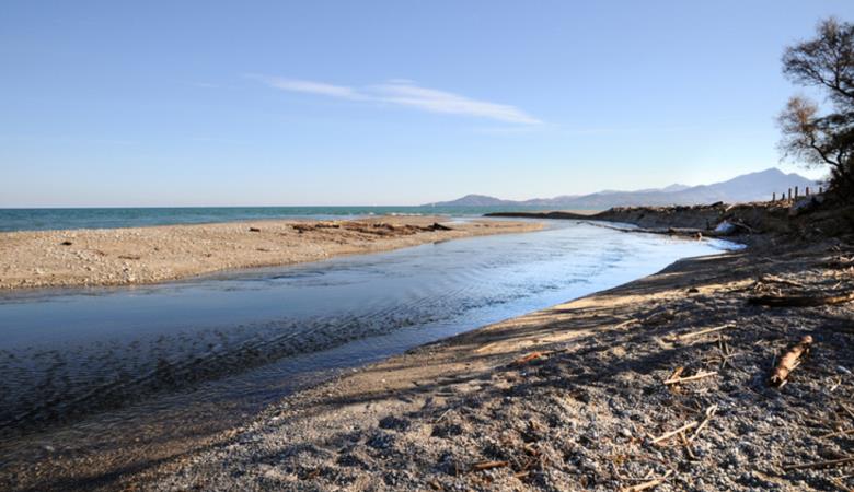
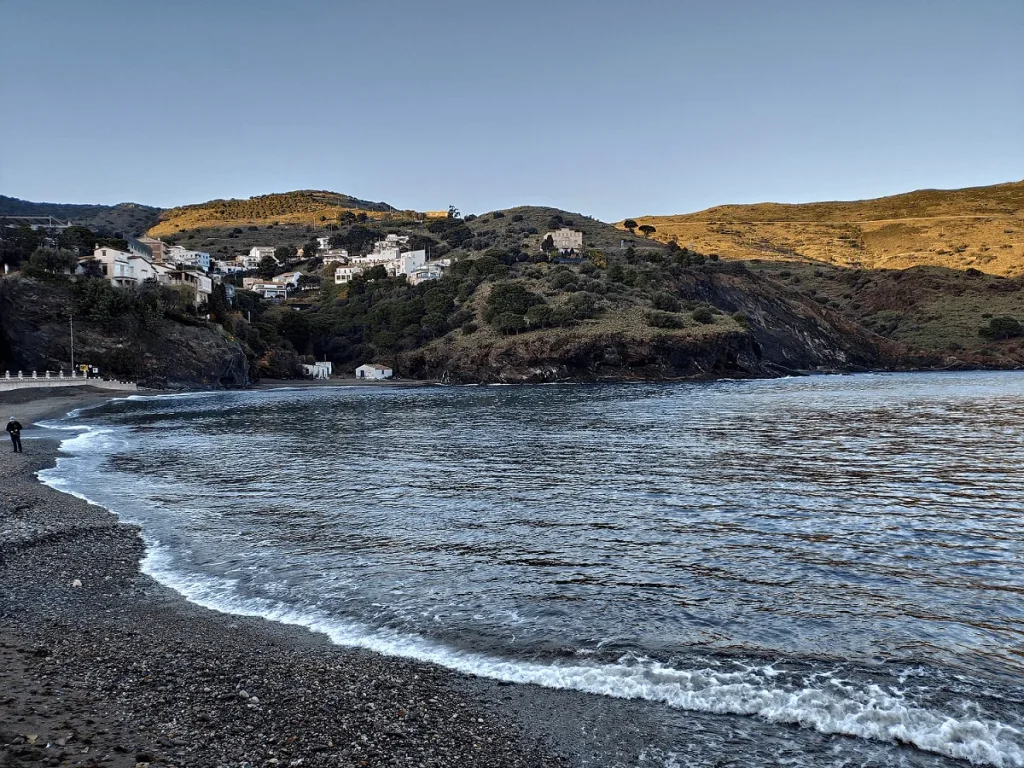
The Mas Larrieu nature reserve to Le Racou
Difficulty 
Discover the first section, which starts at the Mas Larrieu nature reserve and runs alongside the sea as far as Le Racou, a varied landscape of sandy beaches, dunes, reed beds. The landscape is still wild, with a wealth of flora and fauna, combining fresh and salt water.
From the Mas Larrieu reserve beach car park, go right towards Argelès-sur-Mer. Pass the leisure complex and the river Riberette. Continue along the path through the undergrowth and cross the ford. Turn right, then left onto the beach via the Marende car park. Go back to the footpath on the right, following the wooden fencing that protect the dunes of the Marenda Natura 2000 site. After the reed beds, return to the promenade where you’ll find Mediterranean plants leading to the harbour. Head for the docks towards the technical area of the harbour, then go to Le Racou towards the beach.
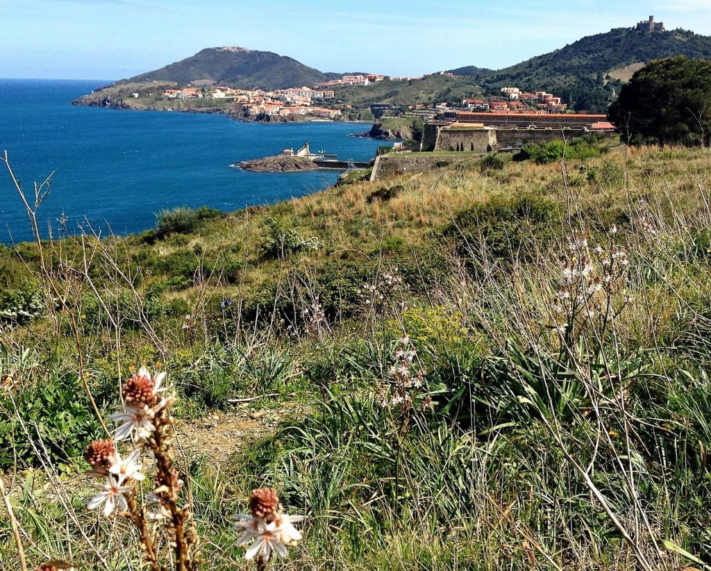
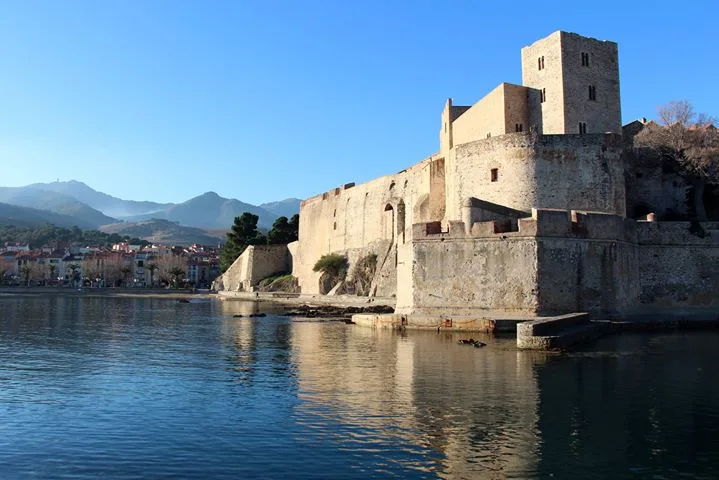
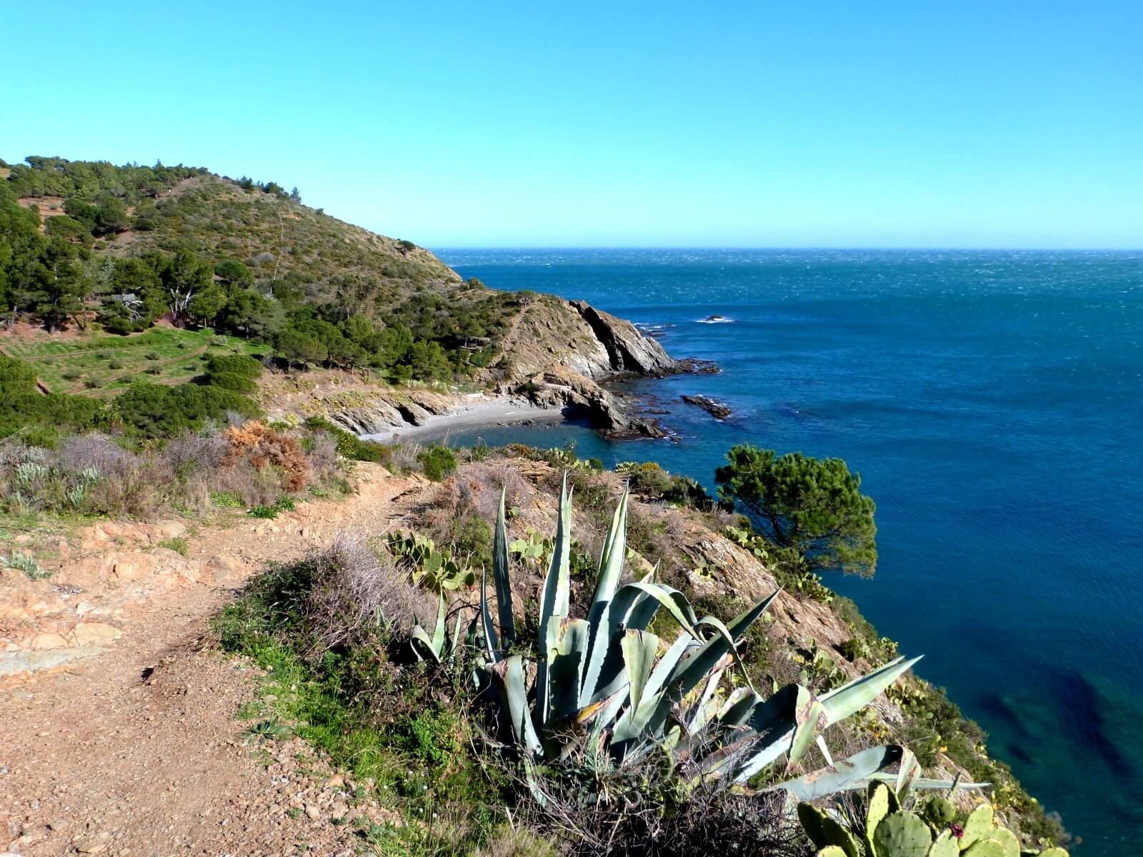
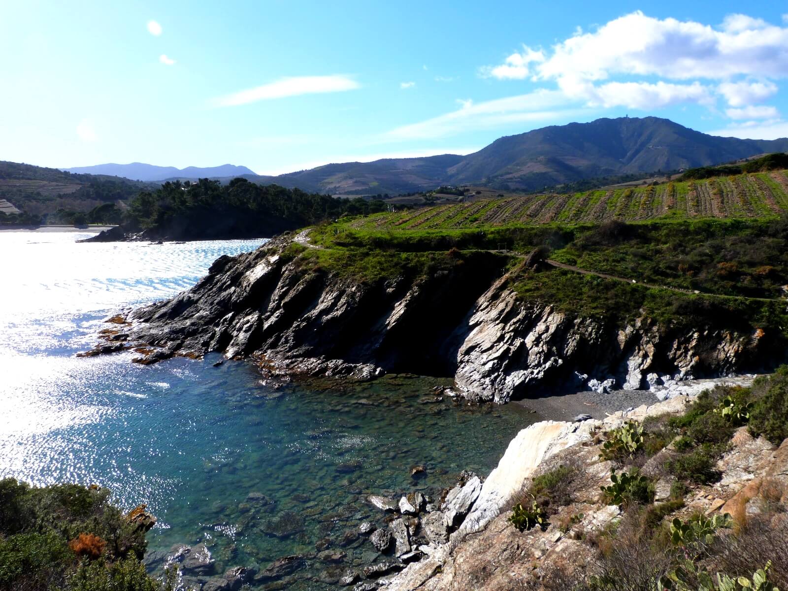
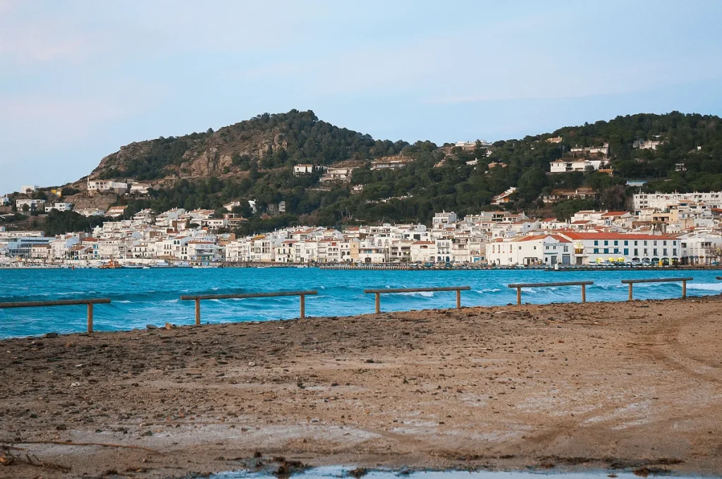
From Le Racou to Collioure
Difficulty
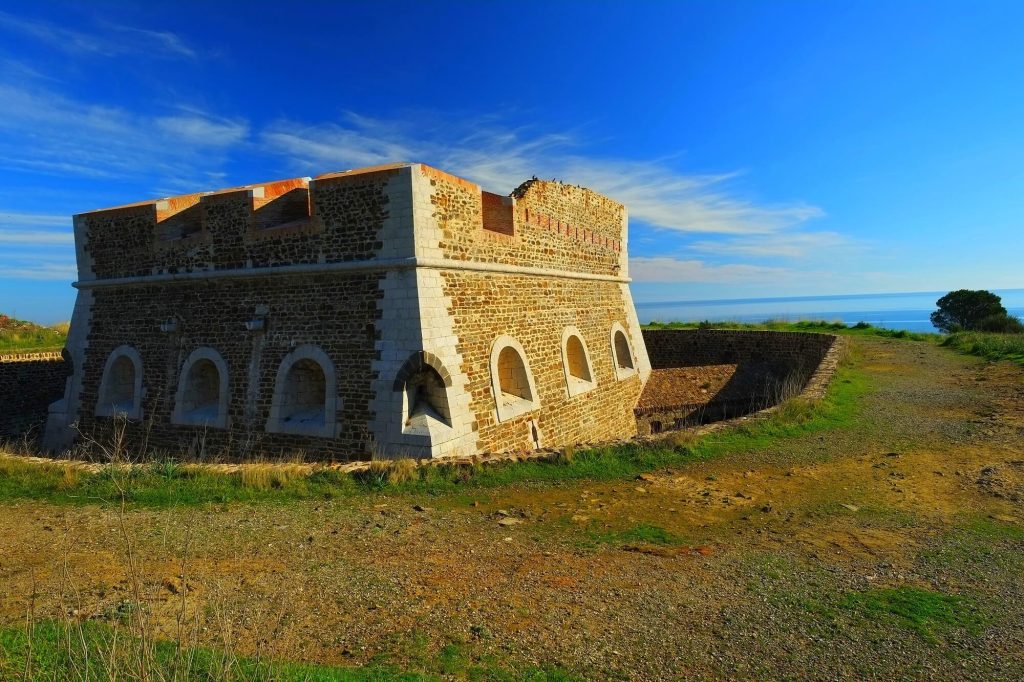
Take a walk along the coastal path, a path made up of shale rock, abundant flora and fauna and numerous small coves where you can go swimming. Don’t miss L’Ouille beach, a beautiful sandy beach you’ll come to before climbing the steps to Collioure! Don’t miss the Fort Rond and Fort Carré on your left, 2 historic heritage sites designed to defend the town from invasion. The view is magnificent, so stop and take in the sights.
Park in the car park at Le Racou, cross Le Racou, go up the path and follow the markings all the way to the Collioure stadium car park, then head down into the village of Collioure to explore the town.
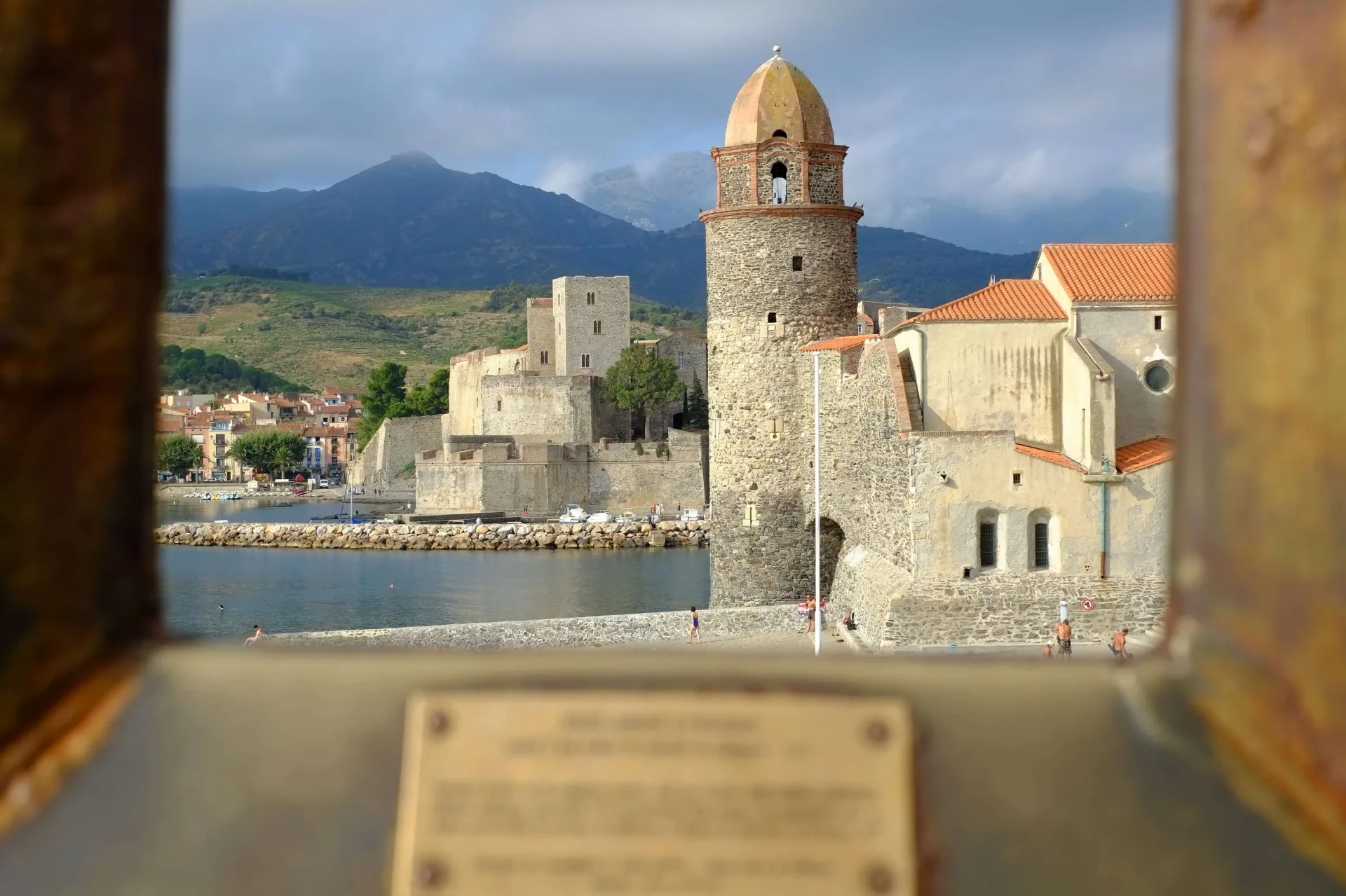
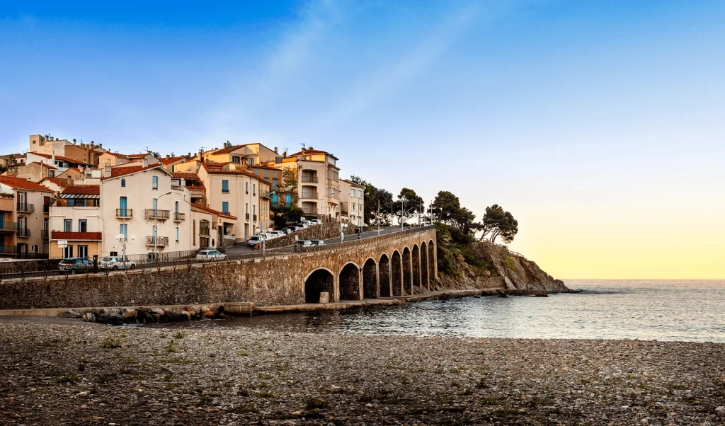
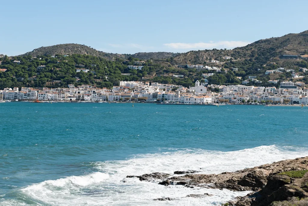
From Collioure to Port Vendres
Difficulty
The section from Collioure to Port Vendres is not particularly interesting, but it does give you access to the rest of the coastal path to Cap Béar and Banyuls.
- When you leave the Tourist Office, turn right and go over the footbridge, then left to go around the Château Royal. Carry on walking to the Faubourg district.
- Continue left along the seafront onto the Esplanade du Faubourg. Continue along the D114 to the Port-Vendres roundabout. Take the 2nd right after Rue Félix-Mercader onto the coastal path as far as Fort de la Mauresque, follow it along the seafront.
- Continue straight on towards the fish market, walk around the port via Rue de l’Artillerie, Quai de l’Obélisque, Quai de la Santé and Quai Forgas. Shortly afterwards, you’ll come to the Port Vendres tourist office.
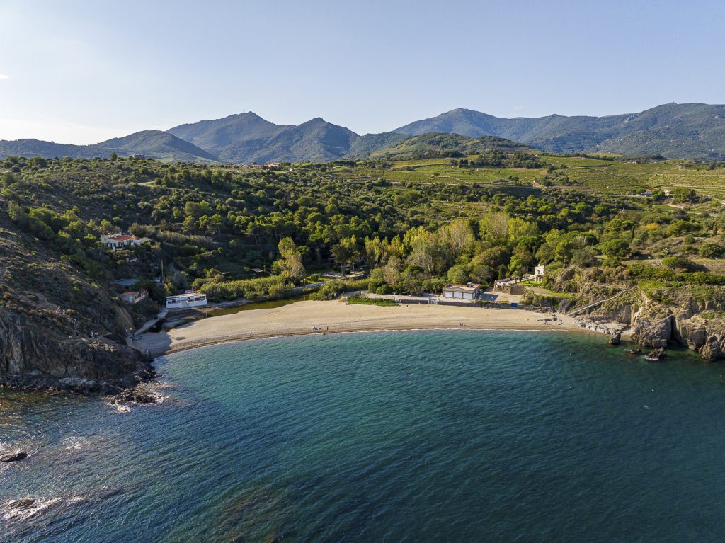
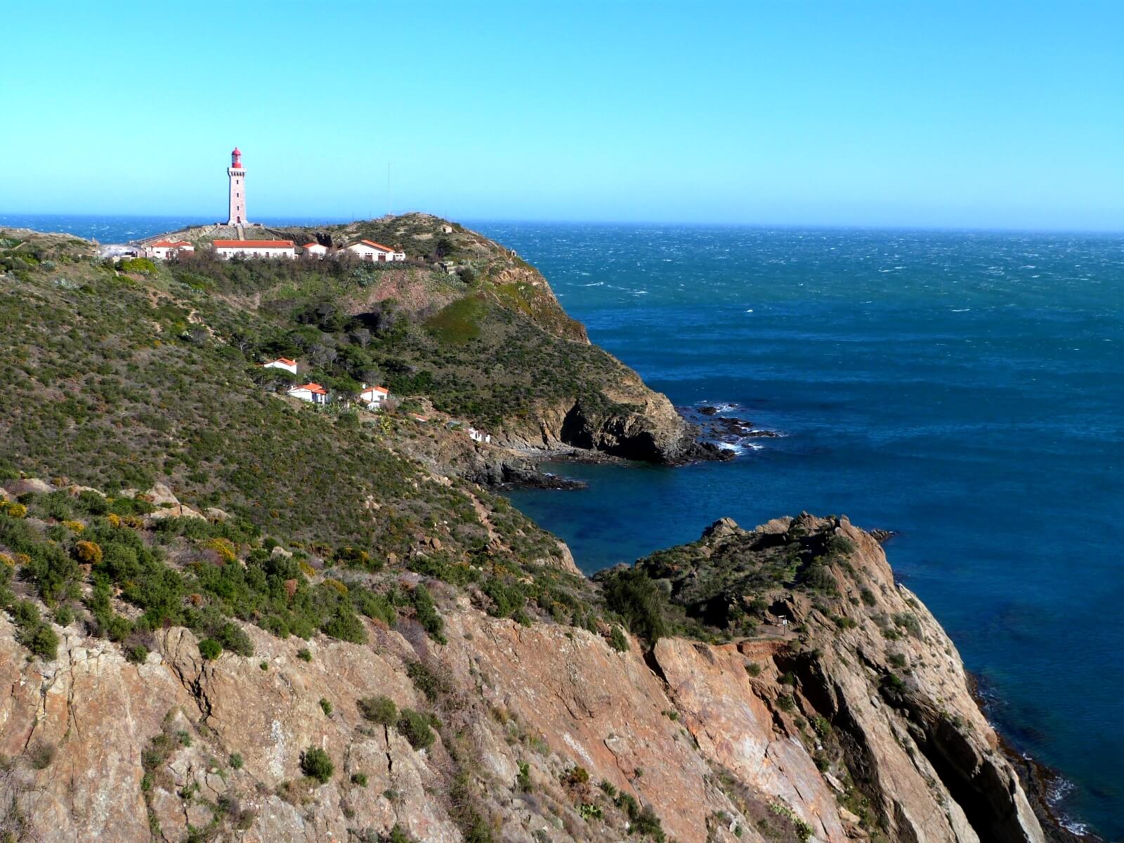
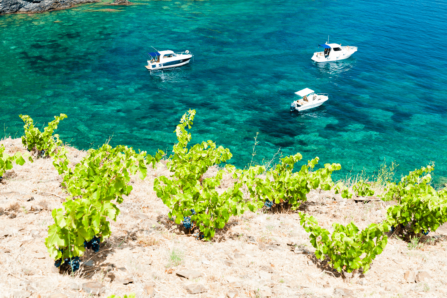
From Port Vendres to Paulilles
Difficulty
This is a very pleasant section with beautiful vegetation, beautiful landscapes and beautiful coves. You’ll also come across the Mackintosh trail in Port Vendres, the bunkers of the Mediterranean wall, the Cap Béar lighthouse and you’ll arrive at the beautiful Paulille beach.
Depart from Port Vendres Tourist Office and head towards the Quai de la République.
At the roundabout, continue along the Quai de la République towards the railway tracks, then turn left as far as the other roundabout. Continue left along the Chemin des Tamarins, then take the Chemin des Criques as far as the last Jetée cove and head towards the Béar and Mailly redoubts. Then follow the markings to Paulilles.

From Paulilles to Les Elmes beach
Difficulty
A beautiful route between beaches and cliffs with the Mediterranean Sea in view all along.
From the Paulilles cove, head for the Fourat beach, where the path will take you up to the cliffs and along the coast. Follow the signs to Plage des Elmes.
From Les Elmes beach to Troc beach
Difficulty
On this section, you can discover the works of Maillol, pass by the Biodiversarium and the beautiful beaches of Banyuls-sur-mer.
- Departure from Les Elmes beach and towards the centre of Banyuls. Go towards the seafront esplanade in the direction of the Tourist Office.
- After the Tourist Office, continue towards the Oceanological Observatory along the Allées Maillol.
- At the far side of the building, turn right and take the steps towards the RD914. Then turn left and head for Troc beach.
From Troc beach to Peyrefite beach
Difficulty
You’ll pass via the Cerbère Banyuls reserve, where you can stop off and go snorkelling to observe the fish on the marine trail starting from Peyrefite beach.
It’s a very beautiful and quite wild trail.
- Leave from Troc beach and follow the path markings.
- The arrival point is on Peyrefite beach.
From Peyrefite beach to the Col des Balistres
Difficulty
Enjoy a beautiful walk combining numerous beaches and wild nature. The route is a little more difficult than the other sections, but the effort is well worth it! You’ll pass Cap Peyrefite, the Terrimbo cove and Cerbère beach. In Cerbère, be sure to visit the village and Le Belvédère du Rayon Vert in Cerbère.
- From Peyrefite beach, head for the Bouffard
- Vercelli rehabilitation centre. Turn left towards Cap Peyrefite and follow the signs to Cerbère.
- When you reach the “Fin du sentier des douaniers” (End of the customs officer’s trail) sign, head towards the Col des Balistres and the Retirada memorial.
- The coastal path continues as far as Rosas. It is marked out as the GR92 trail from the Col des Balistres to the former border post at Cerbère.


From Cerbère to Portbou
Difficulty
From Portbou to Colera
Difficulty
From Colera to Llança
Difficulty
From Llança to El Port de la Selva
Difficulty
From El Port de la Selva to Cadaquès
Difficulty

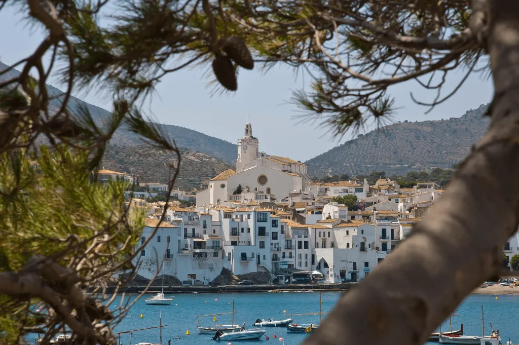
Cadaquès
Arrival at Cadaquès
Key information before coming to Collioure
Is there a website listing all the walks you can do?
Find the coastal path on the geotrek application by clicking here
Can I download the brochure for the coastal path from Argelès to Cerbère?
Click here to download the brochure
Can I find a GPX trail of the coastal path from Argelès to Cadaquès?
Click here to find the GPX trail of the coastal path from Argelès to Cadaquès
Is there a luggage transport service for the coastal path?
There are several companies offering luggage transport services on the coastal path:
- Catalogne découverte
- Abilio taxi: 04 68 82 82 83
- Taxi du Cap cerbère
- Taxi david
- Mini bus voyages
- Balaguères
- Randonnades
Is there an accommodation booking service for the coastal path from Collioure to Cadaquès (or even from Argelès-sur-mer) ?
There are several companies that can help you book accommodation on the coastal path:
Where to park in Collioure?
Here you will find the mid- and low-season and high-season car parks
Where can I find a car parking pass?
Click here for information on car park passes
How to get to Collioure ?
Here you’ll find all the information you need to get to Collioure and around Collioure
What’s the weather like in Collioure ?
Click here to see the weather forecast for Collioure
Is there a page with all the frequently asked questions?
Click here for a list of frequently asked questions.
Can I download a map of Collioure?
Find the map of Collioure here
Is there a cultural application for Collioure?
For more information on the Collioure application, click here